Heavy Storms Hit South Africa: Hail in Cape Town, Snow in the Karoo
Gale force winds and torrential rains have battered parts of the Western Cape today, causing flooding and damaging properties in Cape Town and surrounding areas. And there’s been snow in the Karoo in the Northern Cape. The City of Cape Town Disaster Risk Management said Tuesday that the heavy downpours, which as predicted began on […]


Gale force winds and torrential rains have battered parts of the Western Cape today, causing flooding and damaging properties in Cape Town and surrounding areas. And there’s been snow in the Karoo in the Northern Cape.

The City of Cape Town Disaster Risk Management said Tuesday that the heavy downpours, which as predicted began on Monday night, have affected at least 3,000 dwellings in informal settlements in Masiphumelele in Fish Hoek, Imizamo Yethu in Hout Bay and Makhaza in Khayelitsha.
Flooded roads and power cuts were also reported. Motorists were cautioned to drive safely with visibility poor during the heavy rains and big winds.
Several Capetonians also posted videos and pictures on social media of a hail storm:
https://www.instagram.com/p/B0RAoAYnbwn/
https://youtu.be/qVt0KJjWLGo
A bit if #hail and #rain in #Vyeboom #Grabouw #Western_Cape 📸 Jacques Botes @SAWeatherServic @sawx_sa_weather @eNCAWeather @eNCA @venter_annette @debeer_anika @TeamNews24 @JoelGuy_ @maroelamedia @YouMagazine @zarsg @SABCNewsOnline @AgriWesKaap @landbou pic.twitter.com/Xi3orShNyC
— ReenvalSA (@ReenvalSA) July 23, 2019
According to the South African Meteorological Service the storms will continue until tomorrow (Wednesday).
WATCH Hectic footage of a roof and furniture blowing away:
https://www.facebook.com/SAPeople/posts/10156117039696949/
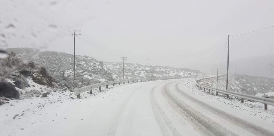
Weather Warnings – “Disruptive” Snow
The South African Weather Service (SAWS) said “disruptive snowfalls” are expected over the Namakwa southern high ground in the Northern Cape and western high ground of the Western Cape overnight, mainly in the morning.
Amazing scenes of snowfall in Sutherland in the Karoo were posted to Snow Report SA on Tuesday:
https://www.facebook.com/snowreportsa/videos/352893985377793/
The SABC in the Northern Cape reported Tuesday night that temperatures in the small Karoo town were expected to drop overnight. According to SAWS, cold temperatures and rain are expected.
https://www.facebook.com/SABCNewsNorthernCape/videos/vb.1759568200931980/344643796464154/?type=2&theater
En so lyk #Worcester #Wes_Kaap se berge getooi met #sneeu 📸 Hugo Lambrecht @SAWeatherServic @sawx_sa_weather @eNCAWeather @eNCA @venter_annette @debeer_anika @AgriWesKaap @SABCNewsOnline @maroelamedia @dieCourant @huisgenoot @zarsg @Netwerk24 @Die_NANB pic.twitter.com/FxRUHD4H27
— ReenvalSA (@ReenvalSA) July 23, 2019
Die wit #sneeu paradys oppad #Sutherland #Noord_Kaap toe 📸 Ignus Verwey @sawx_sa_weather @sawx_sa_weather @eNCAWeather @eNCA @venter_annette @debeer_anika @JoelGuy_ @SnowReportSA @maroelamedia @Netwerk24 @landbou @TheSAnews @SABCNewsOnline @huisgenoot @zarsg @TheSAnews pic.twitter.com/tunyZABGeh
— ReenvalSA (@ReenvalSA) July 23, 2019
SAWS also issued a special weather advisory that light snowfalls are expected over the Sneeuberg and Winterberg mountains tonight (Tuesday) spreading to the southern Drakensberg overnight.
Scattered showers and thundershowers will continue over the Western Cape.
'n #Reënbui wat oor die see aankom in die rigting van #Langebaan #Weskus 📸 Izell Gouws @SAWeatherServic @sawx_sa_weather @eNCAWeather @eNCA @venter_annette @debeer_anika @WeslanderMedia @maroelamedia @SABCNewsOnline @huisgenoot @zarsg @AgriWesKaap @TheSAnews pic.twitter.com/uZpNTEBfSV
— ReenvalSA (@ReenvalSA) July 23, 2019
SAWS said “high seas with wave heights of 6-7m are expected along the coastal regions between Cape Columbine and Coffee Bay” tomorrow.
Gale force winds of 65 km/h are expected along the coast between Cape Agulhas and East London.
The dam good news…
Earlier on Tuesday the City of Cape Town reported that dam levels had thankfully increased a further 2.3% from last week, to 64.1% of storage capacity, thanks to the ongoing rainfall.
Video by Janice le Roux, taken in Somerset West, showed “the Lourensford river burst its banks this morning:
https://www.facebook.com/janice.leroux.7/videos/3031961103511289/