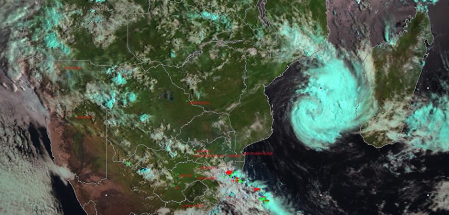
DINEO: Storm Headed to Kruger, South Africa, Forecast to Become Intense Tropical Cyclone
The tropical weather system expected to affect parts of Mpumalanga and Limpopo provinces – including the Kruger National Park – in South Africa later this week, is still on course and expectations are now that it will reach Tropical Cyclone stage. Yesterday the South African Weather Service (SAWS) had reported that it was “not expected to intensify to […]

The tropical weather system expected to affect parts of Mpumalanga and Limpopo provinces – including the Kruger National Park – in South Africa later this week, is still on course and expectations are now that it will reach Tropical Cyclone stage.

Yesterday the South African Weather Service (SAWS) had reported that it was “not expected to intensify to the tropical cyclone stage”. However this has been revised.
SAWS said today that the Regional Specialised Meteorological Centre (RSMC) La Reunion has updated the expected evolution of Tropical Storm DINEO… and it is now expected to reach Tropical Cyclone stage (winds of up to 118-165km/h) early on Wednesday.
SAWS said: “Further intensification is expected and the storm will reach the Intense Tropical Cyclone (winds of up to 166-212 km/h) around midday (Wednesday), before making landfall at midnight near Inhambane in southern Mozambique.
“South Africa will only start to experience the rain from this tropical system on Thursday over the Lowveld, spreading westwards by Friday.”
SAWS said that South Africa will likely experience scattered thundershowers this afternoon over the central, south-eastern and eastern parts with heavier showers possible over the south-eastern parts of Mpumalanga and northern parts of KwaZulu-Natal.
The public is urged to regularly follow weather forecasts on television and radio. Updated information can also be found at www.weathersa.co.za as well as via the SA Weather Service Twitter account @SAWeatherServic