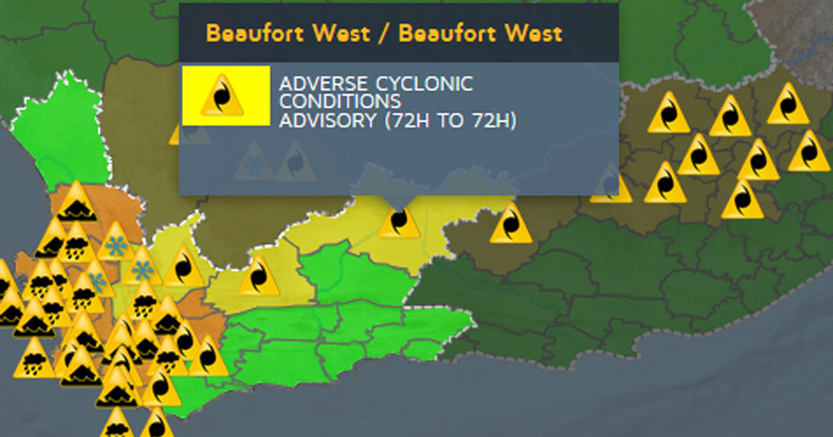
There is NO Cyclone Heading for South Africa
Contrary to reports, although an intense cold front is expected to hit South Africa on Sunday into Monday, there is NOT a tropical cyclone heading for South Africa! The South African Weather Service (SAWS) said on Friday night that the confusion was caused by a symbol used for their alerts. In a playful dig at […]

Contrary to reports, although an intense cold front is expected to hit South Africa on Sunday into Monday, there is NOT a tropical cyclone heading for South Africa!

The South African Weather Service (SAWS) said on Friday night that the confusion was caused by a symbol used for their alerts.
In a playful dig at SAWS, Storm Report Live pointed out that it was confusing for people when SAWS used the international meteorological symbol for a cyclone on their warning map.
SAWS explained: “An ‘Adverse Cyclonic System’ describes ‘a storm system characterized by low pressure centre generating strong winds and flooding’. This description can also be used for a cold front which is also known as a Mid-latitude Cyclone. We apologise for the misleading symbol, however, the alert for the system still remains.”
In other words, there is no cyclone headed for South Africa… but there are severe weather alerts for a lot of heavy rain on the way and localised flooding is expected over the West Coast District, Cape Winelands, Cape Metropole and western parts of the Overberg District.
As reported yesterday, snowfalls are possible in places over the high-ground
and mountainous areas of southern Namakwa, the West Coast District and Cape Winelands on Monday morning. There’s even a chance of snow on Table Mountain!
SAWS also issued special weather advisories for strong interior winds over southern Namakwa and the interior of the Western Cape on Sunday afternoon.
The intense cold front is expected over the Western Cape and southern Northern Cape on Sunday into Monday, spreading to the Eastern Cape on Monday.
“The public and small stock farmers are advised that snowfalls on the high-grounds, very cold and wet conditions and strong to gale force winds can be expected,” said SAWS.
Meanwhile, SAWS says it will look into “how we can correctly symbolise the system for future purposes”.
https://www.facebook.com/stormreportsa/posts/929764150536436
